The excavation in november
1998 has shed some new light on the history of the quarter before the church
was built.

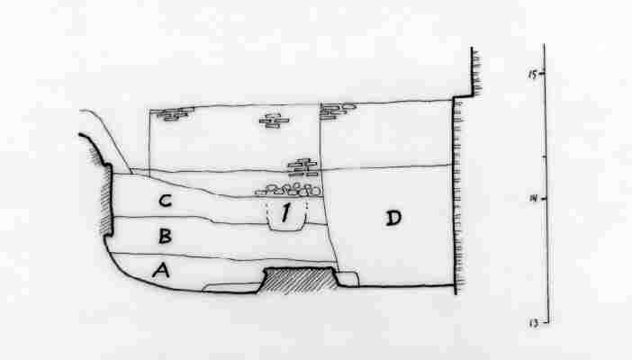
On this plan, the excavated stratigraphy
is marked with grey (click on the plan to see it full size!). A North-South
line (North is up) shows the place of the section shown below. The strata
which were excavated shed no big surprises. The surprise was rather what
they covered. Since the baptistery was first uncovered in 1983, a part
of a foundation wall had been visibile on a level close to that of the
third century insula. The position of the wall made it probable that
it was part of the foundations of the insula, which thus extended to this
place.
But it didn't. This foundation
had no connection to the insula. The building to which this foundation
belonged seems to have been demolished: it was covered by a stratum which
probably should be dated to the late second century. After the demolition
of this building, this must have been an open space west of the big insula.
The careful excavation taught us how difficult it is to trust levels too
much without precise stratigraphical observations, that is, the precise
relationship between the excavated things. Probably this foundation is
part of a second century building, belonging to the same phase as the mosaic
and the painted wall, although not necessarily the same building. And it
also means that this second century building was demolished without being
replaced by another building: in its place, we have an open space in the
same period of the insula, from the third to the fourth century, and the
ground level is gradually raised. This open space and the early date of
the foundation wall means that we have no traces of the insula here, and
it is not necessary to believe that it extended so far. Fragments of wall
paintings found here have nothing to do with those found in the insula.
This space seems not to belong to the insula.
Friedrich Rakob suggested in 1987
that the foundation wall found by the German institute beneath the sacristy
was the outer wall of a great insula, but it cannot be excluded that it
may have belonged to another complex altogether. Rakob meant that the foundation
belonged to the insula period as its ground level is about half a meter
higher than the mosaic room from the second century. But levels are not
enough to date buildings. On the other hand, Rakob probably was right when
he proposed a building with a central courtyard.

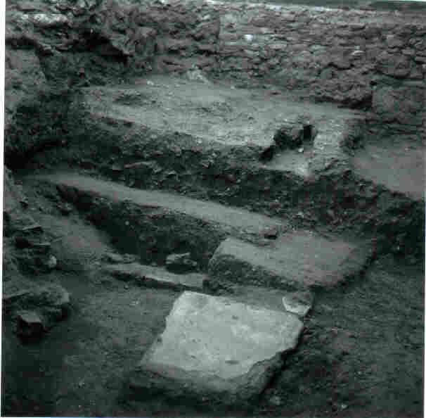
The stratigraphy as it was left,
partially excavated, after the 1995 excavation. In front, you see the foundation
wall of a Second Century building (US 38 and 89), demolished around 200
AD and covered by a new ground level (level A on the drawing; US 85, 87
and 88), in the middle of the photo. The upper layers belong to a later
raised ground level of the fourth century (level B on the drawing; US 78-84).
This level was covered when the ground was raised again, probably only
a short time before the construction of the church (level C; US 77). The
small rectangular hole in these upper layers is a child's tomb, dug in
a later period.

|


